Global maritime domain awareness and vessel analysis
ReleasesLearn about our latest improvements
Arming research analysts with hidden clues to their maritime domain
Global maritime domain awareness and vessel analysis
ReleasesLearn about our latest improvements
Arming research analysts with hidden clues to their maritime domain
Satellite surveillance
Plan, task and rapidly analyse satellite data to detect dark vessels providing greater situational awareness
Starboard is an intuitive web-based platform ideal for satellite surveillance in both fisheries and intelligence. We currently support governments, fisheries organisations, RFMOs and NGOs by bringing people and multiple sources of data together to improve collaboration.
Starboard with MDA Ltd and Unseenlabs conducted intensive surveillance of the fishery for southern bluefin tuna in the Tasman Sea from 2 - 12 May 2022. This operation demonstrates how information from multiple types of satellite sensors comes together in Starboard to support the work of fisheries and intelligence analysts.
Planning satellite surveillance operations
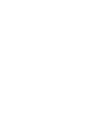
Planning for satellite acquisitions through historical analysis of vessel movements
Longliner vessels are traditionally active in the Tasman Sea during May, however, their fishing patterns have shifted slightly each year.
Watch: Three years of fishing activity for the Japanese longliner fleet
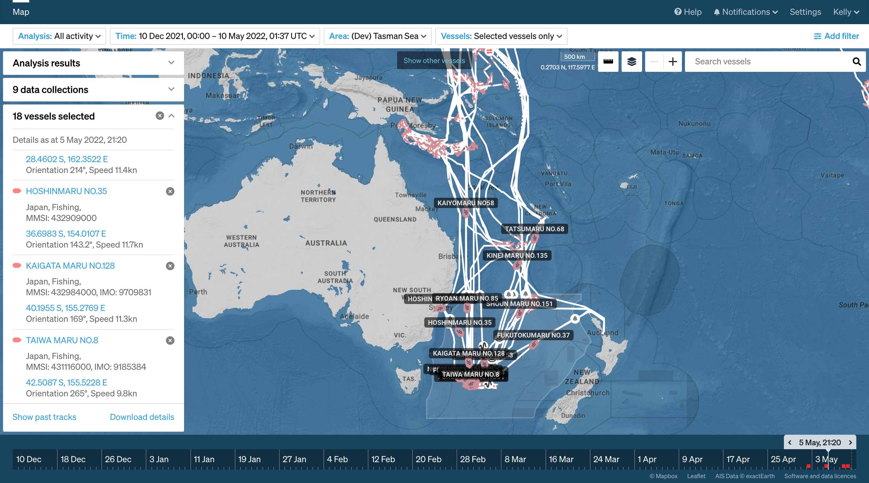
Validating fishing fleet behaviours by assessing oceanographic data
In the Tasman Sea, longliner vessels fish in the productive subtropical frontal zone and the sea surface temperature indicates the location of this front.
Watch: Sea surface temperature in Starboard
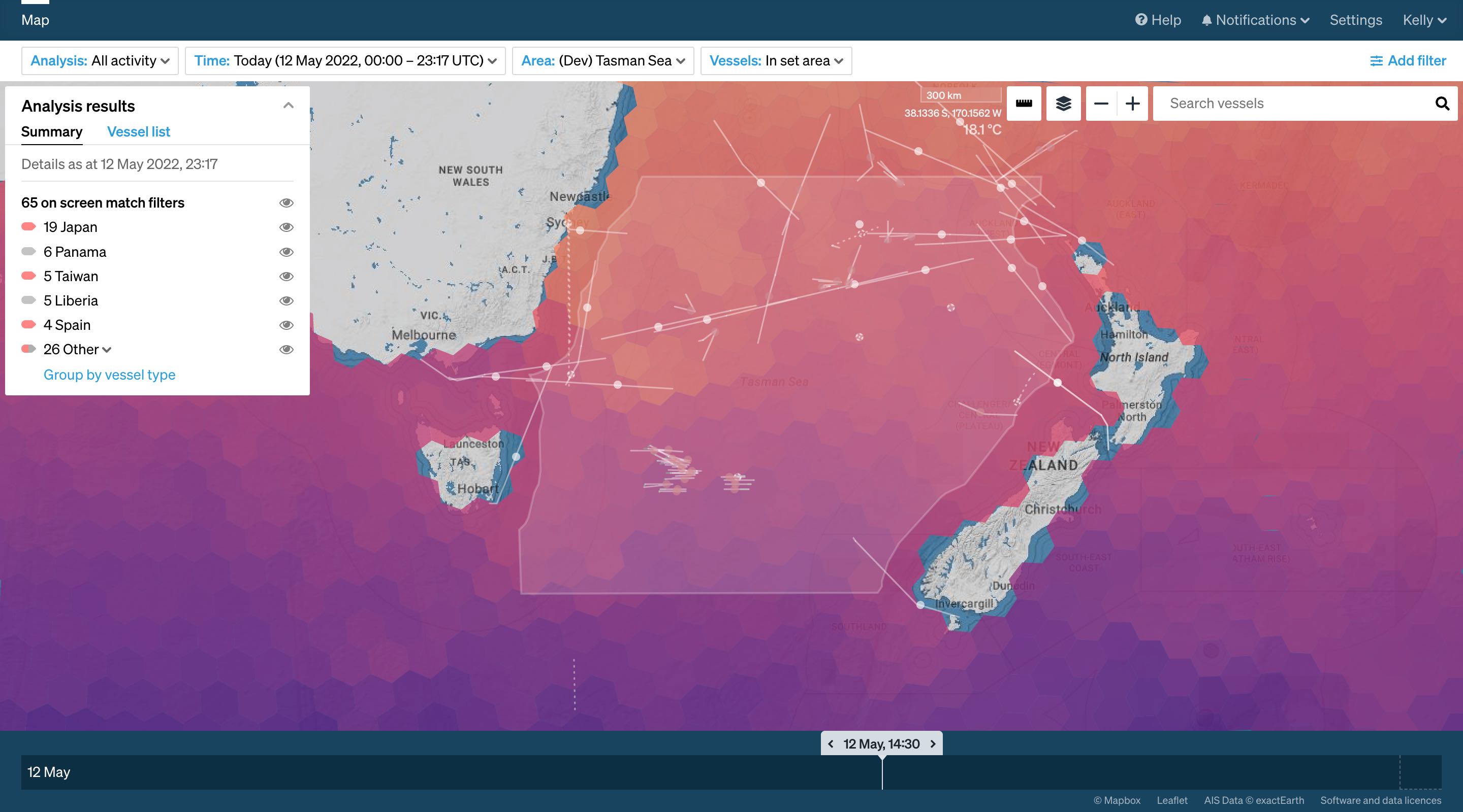
Tasking satellites and adjusting footprints
Integrated analysis tools support satellite tasking
Measurement tools, .geojson overlays, oceanographic information and vessel movements all contribute to the final plans for tasking.
Managing coincident acquisitions for MDA synthetic aperture radar (SAR) and Unseenlabs radio frequency (RF) was supported with these tools during Operation 18c.
Watch: Adjusting acquisition footprints based on analysis
New intelligence gathered can be used to adjust tasking
As an operation progresses and new information is gathered, tasking can be adjusted. This can be done at relatively short notice but the adjustment will depend on the satellite’s orbit.
During Operation 18c we adjusted our MDA Radarsat-2 acquisitions several times.
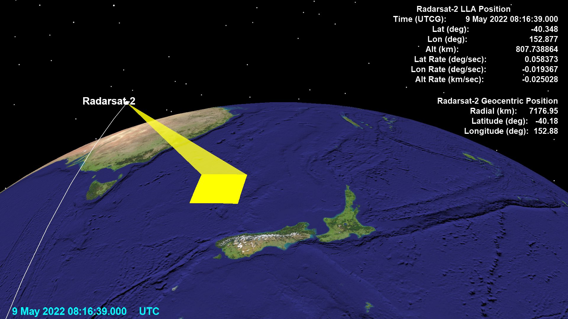
MDA Radarsat-2 collection footprint and orbit
Analysis of satellite imagery and fusing data sources
Situational awareness is faster as fusion with multiple satellite sensors is automated
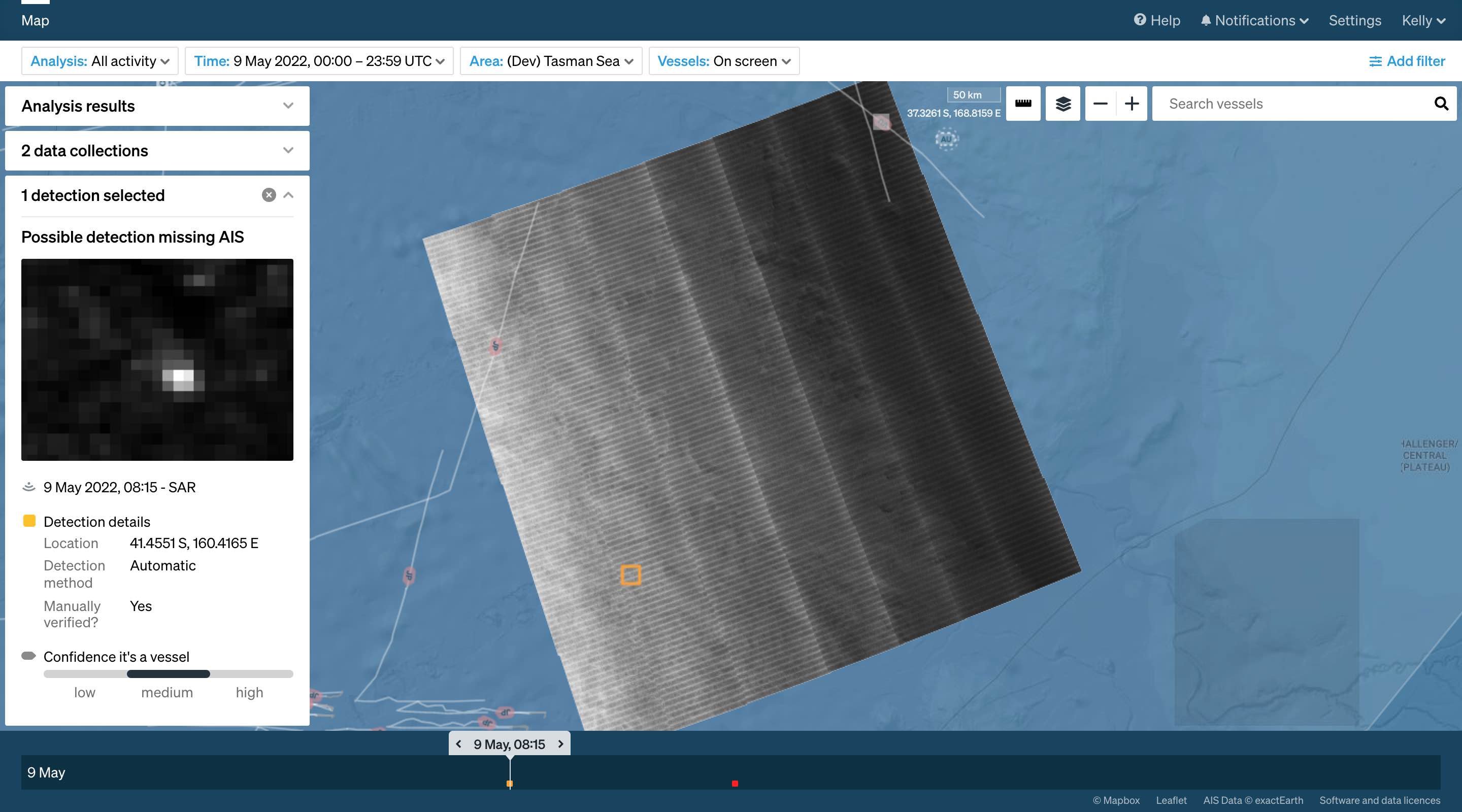
Detections are automatically matched to vessels reporting on the automatic identification system (AIS). Half of all Operation 18c detections were matched leaving around 50 as points of interest for investigation.
Watch: Finding AIS-dark vessels with SAR and RF
Deeper intelligence pictures are enabled through the use of multiple sensor types
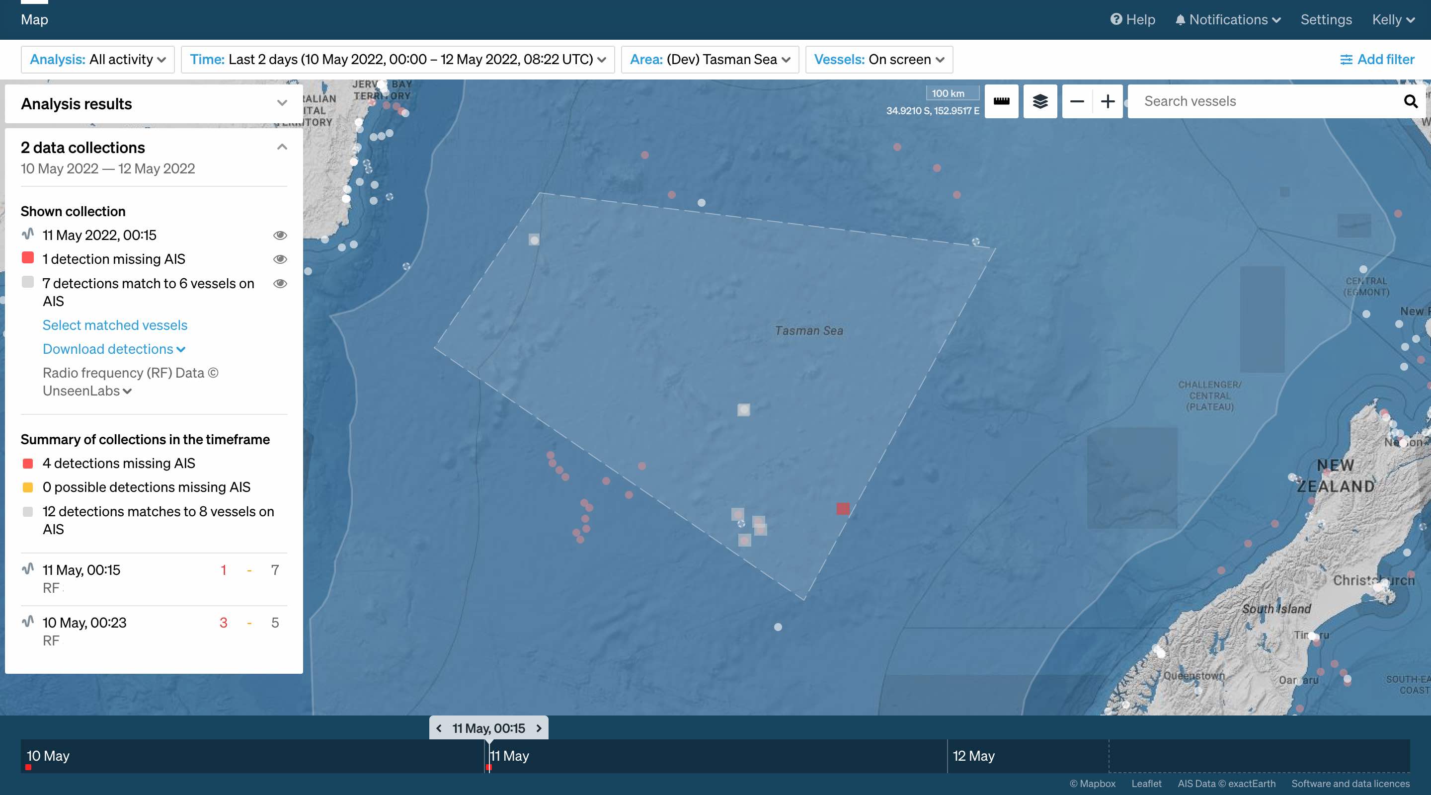
Operation 18c made use of coincident collections for both RF and SAR sensors. Detections in these acquisitions are compared improving confidence that a vessel has been located.
Watch: Analysis of coincident satellite collection
Understand vessel detections in greater detail with speed estimation, exports and layer uploads
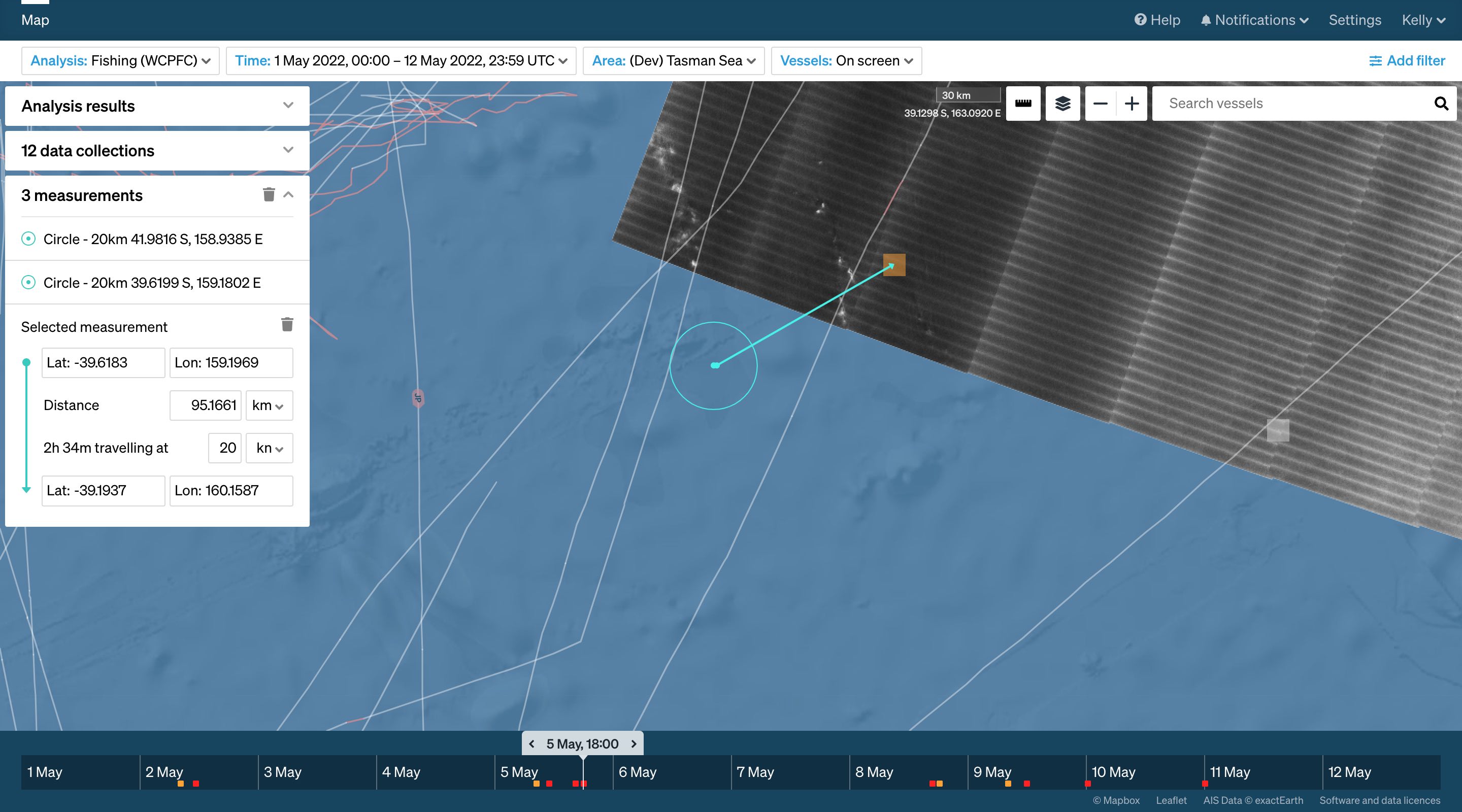
Dark vessel detections are difficult to fingerprint. During operation 18c, measurement tools were used to assess the feasibility of the same vessel being detected during multiple acquisitions.
It is also possible to use export tools and .geojson uploads to compare AIS, satellite detections and proprietary VMS data.
Watch: Using Starboard tools for extended analysis of vessel detections
Rich vessel records as additional data sources are made available to analysts
Starboard is continuing to ingest new sources of data and associate these with vessel records.
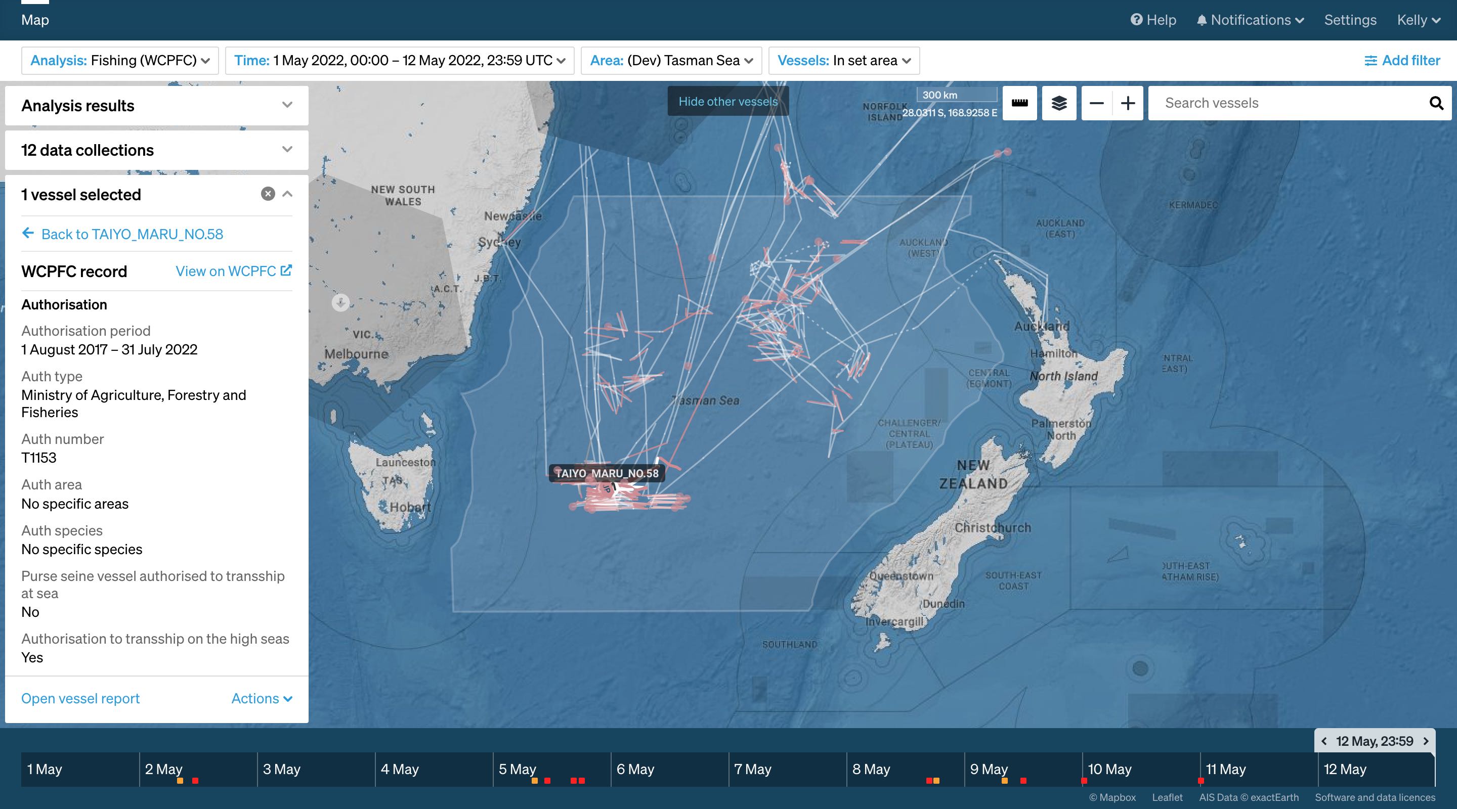
One of these sources is authorised vessel registers from regional fisheries management organisations (RFMO). During Operation 18c vessel registration information was used to understand a vessel’s behaviour and enhance the intelligence picture.
Watch: Using vessel registers for a fuller intelligence picture
Get a demo
Learn more about Starboard and how to plan, task and analyse satellite intelligence.
“It is an amazing tool. The results speak volumes to the level of suspected IUU and related activities. This system has improved risk analysis and dark vessel identification and effective intelligence gathering.”
— Glenda Barr (Fisheries Officer at Papua New Guinea) on Operation Rai Balang 2022
“Starboard has been very useful for tracking ships during Operation Tui Moana. We have found the information provided by Starboard easy to understand and of very good quality. It's one of the only monitoring tools that I know it would be worthwhile us spending money on”
— Navy Intelligence and Operations, Tongan Maritime Coordination Centre
“This has been really useful during Rai Balang because we’ve been able to confirm the locations of suspected vessel interactions and correlate this with reported transhipments and analyse other fishing activity. Using a combination of information in Starboard, like how long a vessel has been at sea and which other boats it has encountered, along with other information and gathered intelligence has given us another layer to how we assess risk and prioritise the boarding of vessels.”
— FFA Director of Fisheries Operations, Allan Rahari
Many data sources, one global maritime domain awareness platform
Starboard is subscription based software that provides teams with a comprehensive view of maritime activity and powerful tools for analysis.
By combining global automatic identification system (AIS) data, multiple layers of satellite data, scientific models, and other information or intelligence, Starboard enables teams to effectively analyse and investigate vessels and areas — all on a secure and intuitive platform.
Releases →
Meet the team →
Our collaborators and data providers